Environmentally conscious manner
The work will be carried out in 4 phases. Phase 1 will deliver the geophysical survey including 2D surveys down to 100m below the seabed. Phase 2 will see the deployment of ROVs to conduct Unexploded Ordnance (UXO) magnetometer surveys. Phase 3 is a 3D Ultra High-Resolution Seismic (UHRS) survey of the Energy Island locations, followed by the final phase, a survey and inspection to assist the Danish Navy with the removal of confirmed UXO.
Once established, the Island will convert and distribute power to several countries
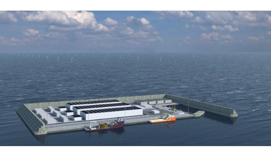
The work will be used to produce a detailed digital map of the seabed and underlying geological layers to allow construction of the artificial island and around 200 offshore wind turbines in both a technically feasible and environmentally conscious manner. Once established, the Island will convert and distribute power to several countries. Initially, it will produce 3 GW of power, increasing to 10 GW in the following years. 1 GW corresponds to the electricity needs of 1 million households.
Future energy islands
Poul-Jacob Vilhelmsen, Project Manager for Energinet’s work on the future energy islands in Danish waters said: “The geophysical studies have to cover a very large area, and it’s important that they meet the time schedule. We are therefore pleased that a very experienced and professional company like MMT will be performing the surveying in the North Sea.”
Per-Olof Sverlinger, CEO of MMT said: “This project is a big step forward in the world’s transition to renewable energy. MMT and the Ocean Infinity group is committed to contributing to a more sustainable future and as such, is delighted to continue our service delivery to Energinet by playing a significant role in the development of this pioneering energy infrastructure; providing the data needed to ensure an environmentally conscious, successful development.”


